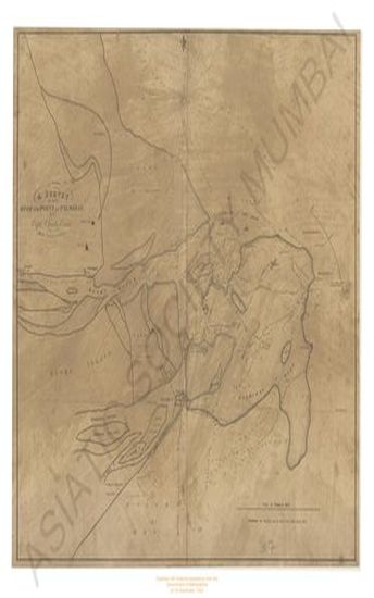
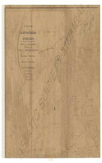
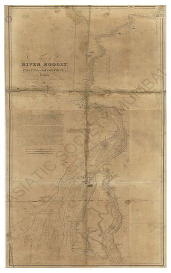
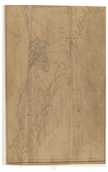
Survey from False point Palmiras to Sauger roads; including the track frequested by ships to the sea reefs and exhibiting the tails of the reef Sauger Sand, the eastern Channel & Lacam's Channel by Capt W. Maxfield.
| Resource Type | : | Map |
| Year/Date of Publication | : | 1819 |
| Subject | : | Topographic Map |
| Publisher | : | James Horsburgh |
| Language | : | English |
| Pages/Folios | : | 1 Map |
| Identifier | : | MAP_0035A |
| Digitization Sponsor | : | Government of Maharashtra |
| File Size | : | 9.4 M.B. |
Other Similar Items
-
-
-
-
-
- An Authentic Account of an Embassy from the King of Gre ...
- Year: 1798
- Author: Earl of Macartney; Gower, Erasmus Sir; Staunton, et al.
-
- An Authentic Account of an Embassy from the King of Gre ...
- Year: 1798
- Author: Earl of Macartney; Gower, Erasmus Sir; Staunton, et al.
-
- An Authentic Account of an Embassy from the King of Gre ...
- Year: 1798
- Author: Earl of Macartney; Gower, Erasmus Sir; Staunton, et al.
-
- Narrative of Voyage to the Polar Sea, during 1875-6 in ...
- Year: 1878
- Author: Nares, G. S. Sir Capt.; Feilden, H. W. (Ed.)
-
- Narrative of Voyage to the Polar Sea, during 1875-6 in ...
- Year: 1878
- Author: Nares, G. S. Sir Capt.; Feilden, H. W. (Ed.)
-
- An Authentic Account of an Embassy from the King of Gre ...
- Year: 1798
- Author: Earl of Macartney; Gower, Erasmus Sir; Staunton, et al.
-
- An Authentic Account of an Embassy from the King of Gre ...
- Year: 1797
- Author: Earl of Macartney; Gower, Erasmus Sir; Staunton, et al.
-