-
- Gujarat Sheet 40 Section 2 : Part of the Godhra Taluka ...
- Year: 1885
- Author: Hodgson, G.B.
-
-
-
-
-
-
-

- Map of the Mawal Taluka Poona (Pune) Zilla.
- Year: 1875
-
- Plan of Ahmednagar.
- Year: 1877
-
-
-
-
- Map of the Yeotmal Taluka, East Berar.
- Year: 1875
-
- Map of the Nandurbar taluka: Khandesh
- Year: 1869
-
- Map of the Belgaum taluka of the Belgaum
- Year: 1878
-
-

-
-
-
-
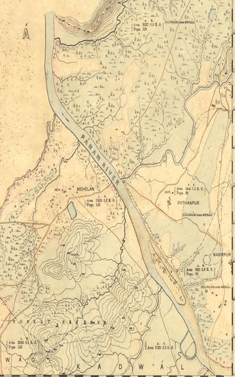
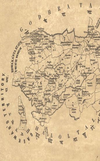
- Gujarat Sheet 40 Section 2 : Part of the Godhra Taluka of the Panch Mahals Collectorate (Season 1882-83)
- Year: 1885
- Author: Hodgson, G.B.
- Subject: Resource Map
- Publisher: Dehradun Office of the Trignometrical branch. Surevy Of India 1885
- Language: English
- Place of Publication: Dehradun
-
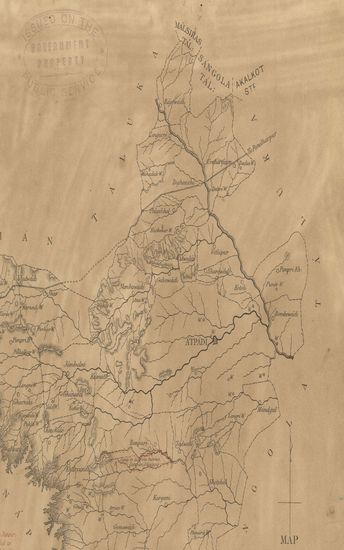
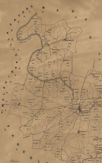
- Map of the Atpadi Taluka of the Pant Pratinidhi State of the Satara Collectorate.
- Year: 1881
- Subject: Topographic Map
- Publisher: Poona (Pune) Government Photozincographic Office 1881
- Language: English
- Place of Publication: Poona (Pune)
-
- Map of the Niphad Taluka; Nassik (Nashik) Collectorate.
- Year: 1871
- Subject: Topographic Map
- Publisher: Poona (Pune) Government Photozincographic Office 1871
- Language: English
- Place of Publication: Poona (Pune)
-
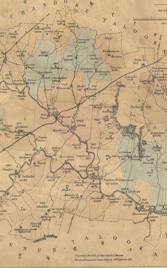
- Map of the Chandor Taluka of the Nasik (Nashik) Zilla.
- Year: 1876
- Subject: Topographic Map
- Publisher: Poona (Pune) Government Photozincographic Office 1876
- Language: English
- Place of Publication: Poona (Pune)
-
- Map of the Kalol Taluka, Panch Mahal District.
- Year: 1878
- Subject: Topographic Map
- Publisher: Poona (Pune) Government Photozincographic Office 1878
- Language: English
- Place of Publication: Poona (Pune)
-
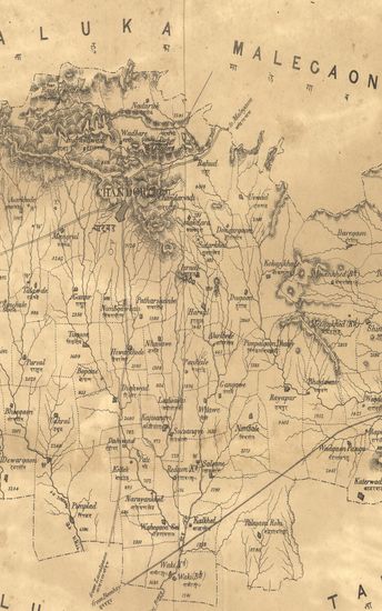
- Map of the Nasik Taluka of the Nasik (Nashik) Zilla.
- Year: 1879
- Subject: Topographic Map
- Publisher: Poona (Pune) Government Photozincographic Office 1879
- Language: English
- Place of Publication: Poona (Pune)
-
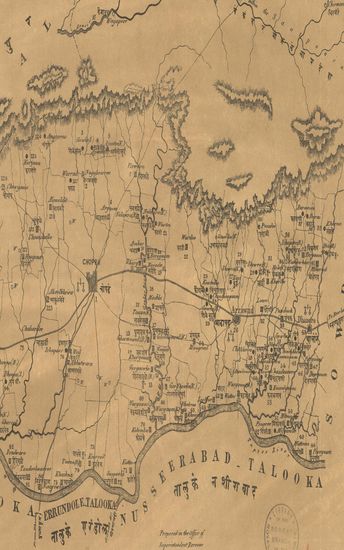
- Map of the Chopra Taluka Khandesh Collectorate .
- Year: 1868
- Subject: Topographic Map
- Publisher: Poona (Pune) Government Photozincographic Office 1868
- Language: English
- Place of Publication: Poona (Pune)
-
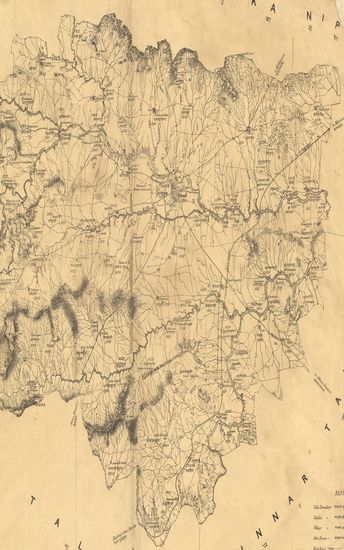
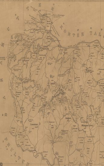
- Map of the Mawal Taluka Poona (Pune) Zilla.
- Year: 1875
- Subject: Topographic Map
- Publisher: Poona (Pune) Government Photozincographic Office 1875
- Language: English
- Place of Publication: Poona (Pune)
-
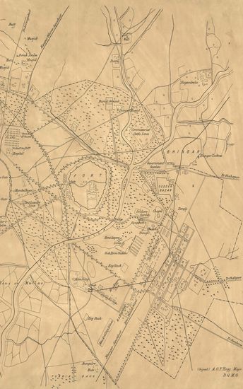
- Plan of Ahmednagar.
- Year: 1877
- Subject: Topographic Map
- Publisher: Poona (Pune) Government Photozincographic Office 1877
- Language: English
- Place of Publication: Poona (Pune)
-
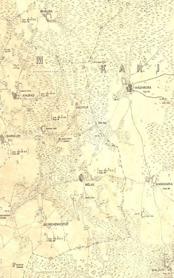
- Guzerat, Sheet No.79 : Parts of the Ahmedabad District, of the Kari Taluka of the Gaikwar's Territory, and of Kattywar (Season 1875-76)
- Year: 1877
- Subject: Physical Map
- Publisher: Dehradun G.T.S Office 1877
- Language: English
- Place of Publication: Dehradun
-
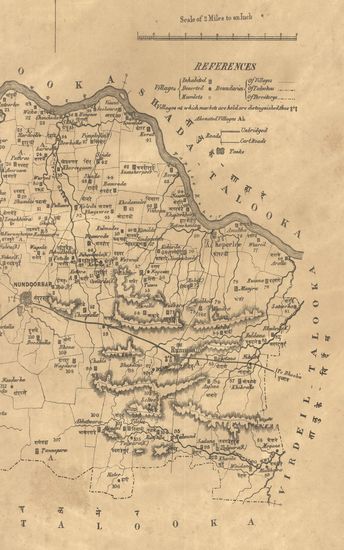
- Map of the Pandharpur Taluka of the Sholapur (Solapur) Zilla. - पंढरपूर तालुका जिल्हा सोलापूर .
- Year: 1872
- Subject: Topographic Map
- Publisher: Poona (Pune) Government Photozincographic Office 1872
- Language: English
- Place of Publication: Poona (Pune)
-
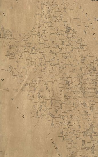
- Sketh Map of the Honnavalli Taluka of the Tumkur District Nandidrug Division, Mysore Territory. 1877
- Year: 1877
- Subject: Topographic Map
- Publisher: Poona (Pune) Government Photozincographic Office 1877
- Language: English
- Place of Publication: Poona (Pune)
-
- Map of the Yeotmal Taluka, East Berar.
- Year: 1875
- Subject: Topographic Map
- Publisher: Poona (Pune) Government Photozincographic Office 1875
- Language: English
- Place of Publication: Poona (Pune)
-
- Map of the Nandurbar taluka: Khandesh
- Year: 1869
- Subject: Topographic Map
- Publisher: Poona (Pune) Government Photozincographic Office 1869
- Language: English
- Place of Publication: Poona (Pune)
-
- Map of the Belgaum taluka of the Belgaum
- Year: 1878
- Subject: Topographic Map
- Publisher: Poona (Pune) Government Photozincographic Office 1878
- Language: English
- Place of Publication: Poona (Pune)
-
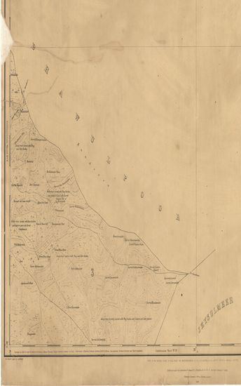
- District Rohree Surveyed in 1856-57. Sind Revenue Survey (Sheet No.6)
- Year: 1869
- Publisher: Calcutta Surveyor General's Office 1869
- Language: English
- Place of Publication: Calcutta
-
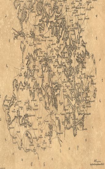
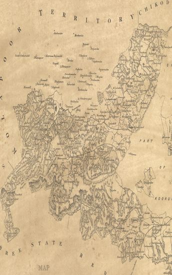
- Map of the Chitaldroog District of the Nagar Division, Mysore. 1877.
- Year: 1878
- Publisher: Poona (Pune) Photozincographed Government Office 1878
- Language: English
- Place of Publication: Poona (Pune)
-
- Map of the Indapur taluka of the Poona (Pune) Zilla.
- Subject: Topographic Map
- Language: English
-
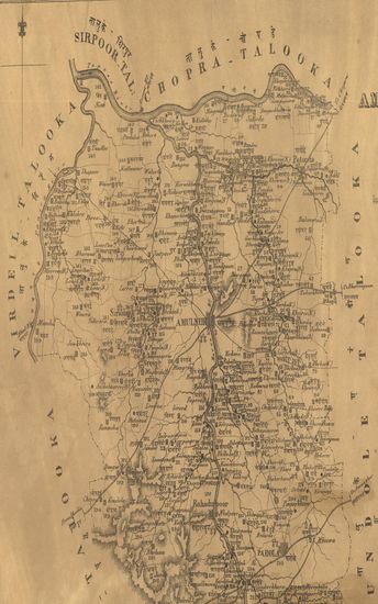
- Map of the Amulneir Taluka, Khandesh including the Petta of Parola. - नकाशा तालुके अमळनेर जिल्हा खानदेश .
- Year: 1869
- Subject: Topographic Map
- Publisher: Poona (Pune) Government Photozincographic Office 1869
- Language: English
- Place of Publication: Poona (Pune)
-
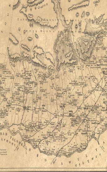
- Map of the Sowda Taluka, Khandesh Collectorate including the Pettas of Ravere & Yawul.
- Year: 1871
- Subject: Topographic Map
- Publisher: Poona (Pune) Government Photozincographic Office 1871
- Language: English
- Place of Publication: Poona (Pune)