

-

-

- Environs Calcutta, Sheet No.2
- Year: 1861
-

- Map of the town and environs of Sukkur
- Year: 1879
-

-

-

-

-

-

-

- City of Surat
- Year: 1877
-

-

- The Times Daily, 16 April 1928
- Year: 1928
-

-

-

-

-
-

- Map of Mehmadabad Taluka, Kaira district
- Year: 1877
-

- Kolhapur water works; general plan
- Year: 1877
-

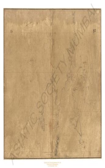
- Trigonometrical survey of Dio harbour
- Year: 1834
-
- Mount Aboo in Rajpootana; plan of the Cantonment and civil station, 1870
- Year: 1871
- Subject: Topographic Map
- Publisher: Surveyor General's
- Language: English
-
- Environs Calcutta, Sheet No.2
- Year: 1861
- Subject: Topographic Map
- Publisher: Surveyor General's
- Language: English
- Place of Publication: Calcutta
-
- Map of the town and environs of Sukkur
- Year: 1879
- Subject: Topographic Map
- Publisher: Government Office
- Language: English
- Place of Publication: Poona
-
- Turkestan with the adjoining portions of the British, Russina and Native territories, 2nd ed. Sheet No.4
- Year: 1873
- Subject: Topographic Map
- Publisher: Office of the Great Trigonometrical survey of India
- Language: English
- Place of Publication: Dehradun
-
- Map of the Surat district, province Gujarat compiled from the village maps of the Gujarat Revenue survey
- Year: 1877
- Subject: Topographic Map
- Publisher: Government Office
- Language: English
- Place of Publication: Poona (Pune)
-
- Map showing revised & original trace of proposed railway from hubli to the Toongabhadra river
- Year: 1879
- Subject: Topographic Map
- Publisher: Government Photozinco office
- Language: English
- Place of Publication: Poona
-
- India; Bay of Bengal; false point to Mutlah river showing the approaches to the sandheads from the Latest govt. Surves 1877
- Year: 1877
- Subject: Topographic Map
- Publisher: Marine Surveyor Department
- Language: English
-
- Derah Ghasze khan district, lower Derahjat, 1856-59
- Year: 1861
- Subject: Topographic Map
- Publisher: Marine Surveyor Department
- Language: English
- Place of Publication: Calcutta
-
- Mount Aboo in Rajpootana; map of the Plateaux of 1870
- Year: 1871
- Subject: Topographic Map
- Publisher: Surveyor General's
- Language: English
- Place of Publication: Calcutta
-
- City of Surat
- Year: 1877
- Subject: Topographic Map
- Publisher: Government Photozincographic Office
- Language: English
- Place of Publication: Poona (Pune)
-
- Trigonometrical survey of Roadstead and Harbour of tutticorin, 1842
- Year: 1846
- Subject: Topographic Map
- Publisher: John Walker
- Language: English
-
- The Times Daily, 16 April 1928
- Year: 1928
- Publisher: The Times
- Language: English
- Place of Publication: London
-
- Premlinary chart of the Mangoler meridional series, season 1865-66& 1866-67. great Trigonometrical survey of India
- Year: 1870
- Subject: Topographic Map
- Publisher: Office of the supdt. Great Trigonometrical survey
- Language: English
- Place of Publication: Dehradun
-
- Turkestan and the countries between the British and the Russian dominions in Asia 4th ed.
- Year: 1879
- Subject: Topographic Map
- Publisher: Office of the Great Trigonometrical survey of India
- Language: English
- Place of Publication: Dehradun
-
- Turkestan and the countries between the British and the Russian dominions in Asia. 5th ed. Sheet No.2.
- Year: 1881
- Subject: Topographic Map
- Publisher: Survey of India Offices
- Language: English
- Place of Publication: Dehradun
-
- South konkan meridionial series; preliminary chart of; Great trigonometrical survey of India. Season 1842-44 & 1864-66.
- Year: 1871
- Subject: Topographic Map
- Publisher: Surveyor general office
- Language: English
-
- Andaman islands; chart of the : 1789-1790; (chart of the coast of the Great Andaman and adjacent islands. 1789)
- Year: 1790
- Subject: Topographic Map
- Publisher: A.Dalrymple
- Language: English
-
- Map of Mehmadabad Taluka, Kaira district
- Year: 1877
- Subject: Topographic Map
- Publisher: Government Office
- Language: English
- Place of Publication: Poona (Pune)
-
- Kolhapur water works; general plan
- Year: 1877
- Subject: Topographic Map
- Publisher: Government Photozinco office
- Language: English
- Place of Publication: Poona
-
- Trigonometrical survey of Dio harbour
- Year: 1834
- Subject: Topographic Map
- Publisher: James Horsburgh
- Language: English